Many of us care because:
- It will cost the taxpayers money.
- It will cause damage to the environment in the Cherry Point area - including damage to the marine.
- It will dramatically increase railroad traffic in this state and numerous bridges, crossings etc. will have to be built, repaired, replaced, upgraded - most at taxpayer expense.
- The actual net jobs in Whatcom County could decline and actual costs could increase dramatically to the taxpayer.
In 2008 a bill was introduced into the legislature by a local State Senator that would have all of the taxes generated by a super port go directly for paying the infrastructure costs of roads, spur lines, sewer and water mitigation, emergency services and environmental mitigation costs. Senate Bill 6616.
It did not make it out of committee - that time.
So you have to ask yourself.... if it is going to cost taxpayers money, if it is not good for the environment, if net jobs could be a loss, if it could create health issues for children and the large population of retirees nearby, if additional damage could happen in the Salish Sea by the additional hundreds of ships,
if property values decline why would we want to do this?
Especially if they, the Port of Vancouver have already looked at expansion at Roberts Bank and other areas that could meet increased requirements by overseas markets.
And then there is the whole issue of strategic defense of the United States - why does our generation have the right to deplete coal reserves that may be required in a hundred years - when technology may have caught up and dramatically reduced or eliminated the whole issue of the massive carbon footprint of burning coal for energy requirements.
And then there is the moral issue...............
all photographs copyright 2011 by Paul K. Anderson please click on any photo to enlarge.
Saturday, April 23, 2011
Coal Trains - Where are they Going? Why Do We Care? Part 3
The coal trains that I have shown on this site and that pass through many of Washington's most populated areas - Seattle, Everett, Mt. Vernon, Bellingham, Ferndale and just above the Salish Sea at the base of the Chuckanut Range are headed for a shipping facility just across the border at Roberts Bank.
The super port has been there for 40 years and they have frequently upgraded to more modern technology. But even with all of their efforts, the number one issue that they work on is dust suppression. The coal that they ship is in a crushed granular state - not the large chunks that many of us remember from stories our parents told about rocks that burn.
They ship approximately 24 million tons a year from a roughly 120 acre site. They have typically (per their spokesman) 225 ships a year call at the port.
The proposed site at Cherry Point is going to have a footprint of about 80 acres and a spokesperson for Peabody Coal said they will ship up to 48 million tons of coal.
For those of you that don't know what a coal shipping facility looks like and how it may affect us at Cherry Point and along the train route through the Chuckanuts - here are some images from my recent visit.
all photographs copyright Paul K. Anderson - The Chuckanut Conservancy
Sunday, April 17, 2011
Blanchard Mt Fly-In
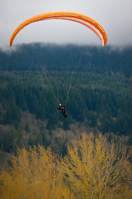
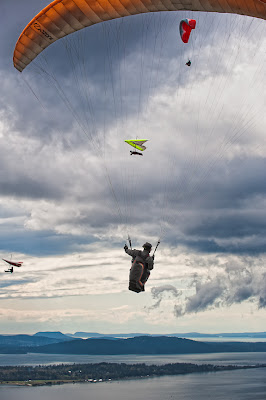
Members of the Hang Gliding and Paragliding community are meeting this weekend for their annual fly-in. Take off is from the launch site high on a shoulder of Blanchard Mt and the landing is in Chuckanut Conservancy's Treasurer Thom Wake's front yard.
This is an excellent opportunity for photographers to find good compositions of these pilots. It is also used as a fundraiser for the Chuckanut Conservancy as many of the pilots stop by the booth set up by Thom and Kris Wilkening and generously donate. The pilots and organization are very appreciative of Thom Wake for allowing them to land in his field over the years and Thom generously donates the proceeds of these donations to the Conservancy.
Stop by the table Thom has set up and buy a Chuckanuts map and bumper sticker and donate to a good cause and organization.
All photographs copyright Paul K Anderson 2011
Saturday, April 9, 2011
Summer Sunset
Just to the right of center on the horizon is the British Columbia Superport, you can see the cranes for loading the sea containers onto the ships. The West Shore Coal Loading facility already in operation for a number of years is adjacent to the towers seen here from Blanchard Mountain at the south end of the Chuckanuts.
 |
| All Photos Copyright Paul K. Anderson 2011 The View from Blanchard Mountain |
Here are several images from Ferndale, Washington yesterday afternoon.
 |
 |
| Crossing the Nooksack |
If this super port goes through what could follow - demands that they can't compete, that they need to double/triple the shipments or they leave. Will the refineries ask to enlarge, will petrochemical plants eventually come in to produce plastic bottles to ship bottled water (water brought in from Canada via pipelines owned by oil companies) to Japan and countries stricken stricken with climate change?
I'm just asking so full discussions can take place.
Better to not open this pandoras box.
I'm just asking so full discussions can take place.
Better to not open this pandoras box.
Friday, April 8, 2011
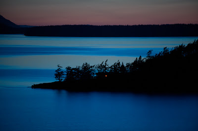
Clark's Point - Chuckanut Bay
Quick snap shot last night while returning from dinner at the Edison.
 |
| copyright 2011 Paul K Anderson |
Friday, April 1, 2011
Samish River at High Levels Again
For the fourth time this winter the Samish River has risen significantly after prolonged rains. Local residents in the flats below Blanchard Mountain and near the river have been dealing with the flooding. It's a combination of numerous factors - none of them all that easy to fix. Logging, dikes in one area affecting the flood plain in other areas, multiple jurisdictions, heavier rains than normal, climate change, coincidence....
It's not a major event like floods in other parts of the world but it illustrates how our neighbors, friends can be affected by events to which they may not have any control or power over.
Here are a few images from yesterday afternoon along the Samish River.
All photos copyright Paul K. Anderson 2011
Subscribe to:
Posts (Atom)


